 Just because we are no longer holding our car show in Schenley Park on July 25/26 doesn’t mean that you still shouldn’t get out and enjoy your car on the open road that weekend! Many of our car clubs partners have taken the initiative to stage scenic driving tours around Pittsburgh on the same weekend we were scheduled to race in Schenley Park.
 We suggest that your car club arrange your own tour and drive the beltways on the July 25/26 weekend at your own pace. Start wherever you like and we’re sure that you’ll see other Grand Prix fans along the way. To help raise money, your participants can make a donation to the PVGP charities HERE – it’s up to your club to determine the amount that you ask participants to donate. It’s all about raising funds for our charities who need your help more than ever. Please ask participants to enter their car club name when they register so that we can give your club the proper credit!
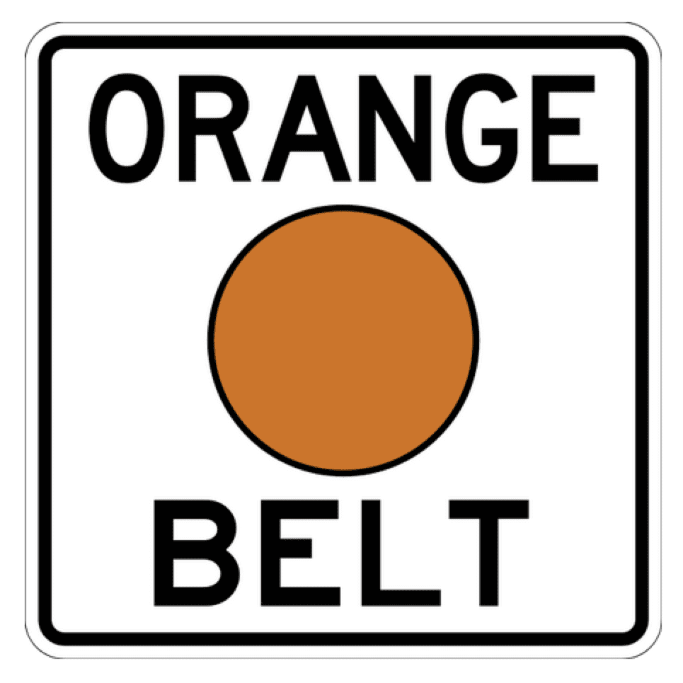
The following PVGP Car Clubs plan to participate in the Orange Belt Tour. The PVGP and it’s charities thank you for your efforts!

The Allegheny County Belt System was developed in the late 1940s by Joseph White, an engineer with the Allegheny County Department of Public Works, as a wayfarer system using a network of federal, state, and municipal roads to offer residents alternative traffic patterns which did not lead to downtown Pittsburgh’s congested Golden Triangle. As such, it actually predates the Interstate Highway System developed during the Eisenhower administration.
The Belt System consists of six beltways. The Purple, Blue, Green, Yellow, Orange, and Red Belts travel distances of 2 miles, 38 miles, 39 miles , 78 miles, 92 miles, and 34 miles, respectively. The Purple, Blue, and Yellow belts are complete circular routes, beginning and ending at the same points. The Orange Belt was a complete circle until 12 miles of the southernmost stretch (including its entire stretch through Washington County) was decommissioned in the 1970s to keep the belt system entirely in Allegheny County. It still briefly traverses Westmoreland County in New Kensington.
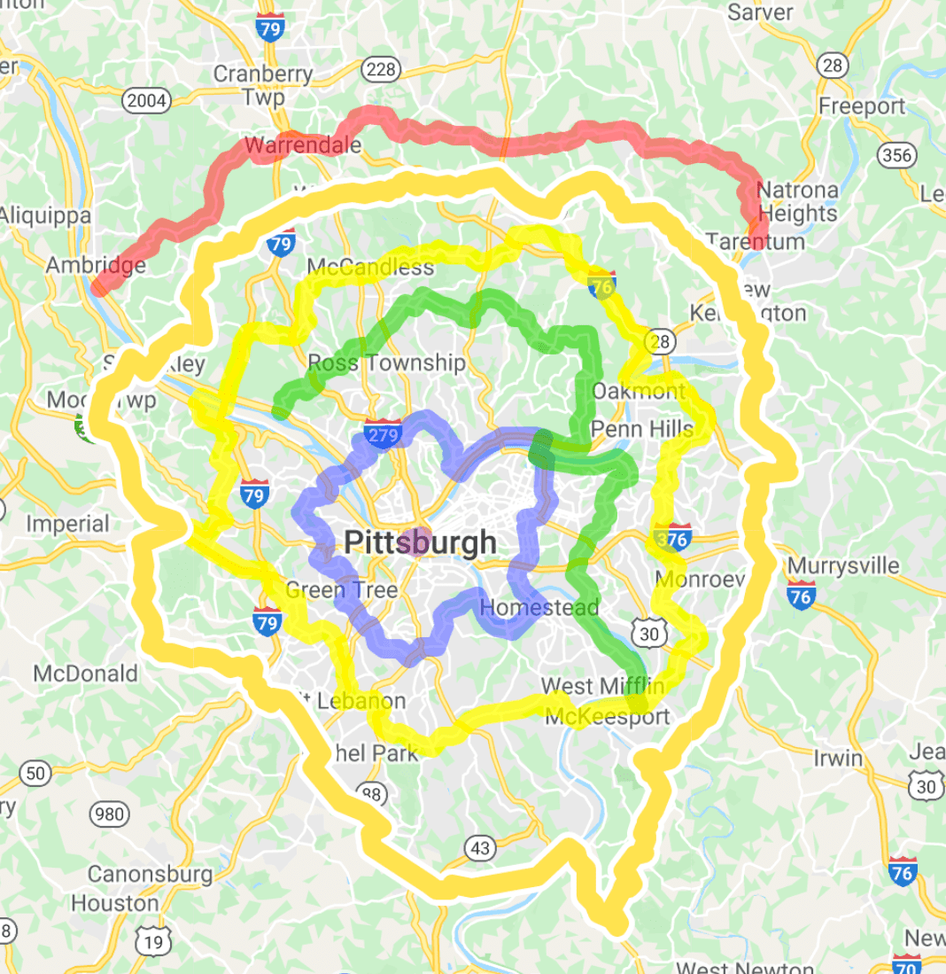 The Orange Belt runs through the northern, eastern, southern, and western sections of the county, connecting four county parks (including South Park and North Park) and the Pittsburgh International Airport.It stretches from its southwestern terminus at PA 88 in Bethel Park northwest to Moon Township and Sewickley , then northeast to Richland Township and West Deer Township, southeast to Plum and Monroeville , and finally southwest to its southeastern terminus at PA Route 51 in Elizabeth. Much of the route was previously rural, though suburban sprawl has placed it in many prominent commercial corridors.
The original Orange Belt completed a 121-mile (195 km) circle by crossing into Washington County, but the southernmost stretch from Bethel Park to Forward Township, including the entire 8.5-mile (13.7 km) Washington County segment, was removed by early 1973 to keep the Belt system within the Allegheny County border (with the exceptions of the brief stretch of this belt in Westmoreland County and two short segments of the Red Belt in Beaver County).
Starting at the intersection of Library and Clifton Roads in Bethel Park where the Orange Belt currently terminates from the southwest, the former segment begins at PA 88 South through Library and Finleyville (Washington County), then continues left onto Washington Avenue / Finleyville–Elrama Road, left onto PA 837 North (back into Allegheny County), and right onto PA 51 South for 2 miles (3.2 km) to the current southeastern terminus at PA 48 North.
Originally, the Orange and Yellow Belts were the only two in the system to cross all four major Allegheny County rivers. Today, only the latter carries that distinction as the former’s decommissioned segment includes the crossing of the Monongahela River via Malady Bridge (PA 51) between Elizabeth and West Elizabeth.
Apparently the Sewickley Bridge will be closed on the July 25/26 weekend so you might need to reroute